I found this list on the Maine Office of Tourism and wanted to share.
This list reminded me of a placemat they gave out at a restaurant somewhere along our travels on vacation when I was a child. According to the information on the placemat – and we all know just how much research goes into such publications on a paper placemat used at roadside restaurants – the doughnut hole was invented in Camden, Maine.
That information is not included on this list, but perhaps it should be.
State Capital: Augusta
State Cat: Maine Coon Cat
State Nickname: Pine Tree State
State Fish: Landlocked Salmon
State Motto: Dirigo (“I lead”)
State Insect: Honeybee
State Bird: Chickadee
State Tree: White Pine
State Floral Emblem: White pine cone and tassel
State Animal: Moose
State Fossil: Pertica quadrifaria
State Gemstone: Tourmaline
Maine…
• … is recognized as one of the most healthful states in the nation with summer temperatures averaging 70° F and winter temperatures averaging 20° F. [Maine and the other five New England states were in the top 10 healthiest states in a report released yesterday. I blogged about it yesterday and there are links to the story and to the full report. – KM]
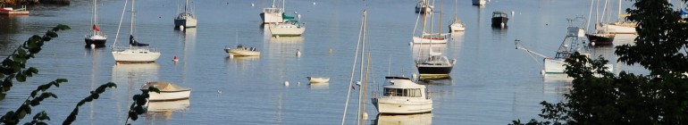
• … has 5,500 miles of coastline, and about 2,000 islands off the coast.
• … is about 320 miles long and 210 miles wide, with a total area of 33,215 square miles or about as big as all of the other five New England States combined.
• … consists of 16 counties with 22 cities, 435 towns, 33 plantations, 424 unorganized townships, and 1.2 million residents.
• … has 542,629 acres of state and national parks, including the 92-mile Allagash Wilderness Waterway, Acadia National Park and Baxter State Park (location of Mount Katahdin and the northern end of the Appalachian Trail.) [I have been down the Allagash Wilderness Waterway and have visited the other two parks named. I hope to visit them again. – KM]
• … has one mountain which is approximately one mile high: Mount Katahdin (5,271 ft. above sea level). [I believe Mount Katahdin also is the official end of the Appalachian Trail. – KM]
• … has the largest wild blueberry crop in the nation, raising 99 percent of all wild blueberries in the United States and is the single largest producer of any blueberries (wild or cultivated) in the United States.
• … ranks seventh in acreage and tenth in production of potatoes nationally. [I’m dating myself, but I picked potatoes by hand one season. That was enough. – KM]
• … is nationally famed for its shellfish. Almost 90 percent of all American lobster are trapped in Maine.
• … is the most sparsely populated state east of the Mississippi.
• … is the only state in the continental U.S. to be bordered by only one other state (New Hampshire).
• … includes Aroostook County which is so big (6,453 square miles) that it actually covers an area greater than the combined size of Connecticut and Rhode Island. [I was born and raised in Aroostook County or “The County,” as it is known within the state. – KM]
• … contains 32,000 miles of rivers and streams equal to more than the combined length of the Mississippi, Amazon, Yangtze and Nile rivers.
• … claims America’s first chartered city: York, 1641.
• … entered the Union on March 15, 1820, as the 23rd state. Thomas Jefferson wrote portions of Maine’s Constitution. [I did not know this. I’m am glad that I now do know this. – KM]
• … has over 60 lighthouses.
• … produces 90 percent of the country’s toothpick supply.
• … is where Chester Greenwood invented the earmuffs in 1873. [I knew this! — KM]
• … is home to the Penobscot Narrows Observatory, the tallest public bridge-observatory in the world.
— Source: Maine Office of Tourism website, www.visitmaine.com
Believe it or not, I actually knew some of this stuff.